Help & guide
Getting started
This is a catalogue of the oldest buildings and structures in the British Isles: the United Kingdom, Ireland, the Isle of Man and the Channel Islands. It holds everything begun before 1500, the oldest surviving example of each type of building, and landmark buildings of any date (Grade I, Category A, World Heritage Sites and other widely known structures), plus tens of thousands of places of interest and the people connected with them.
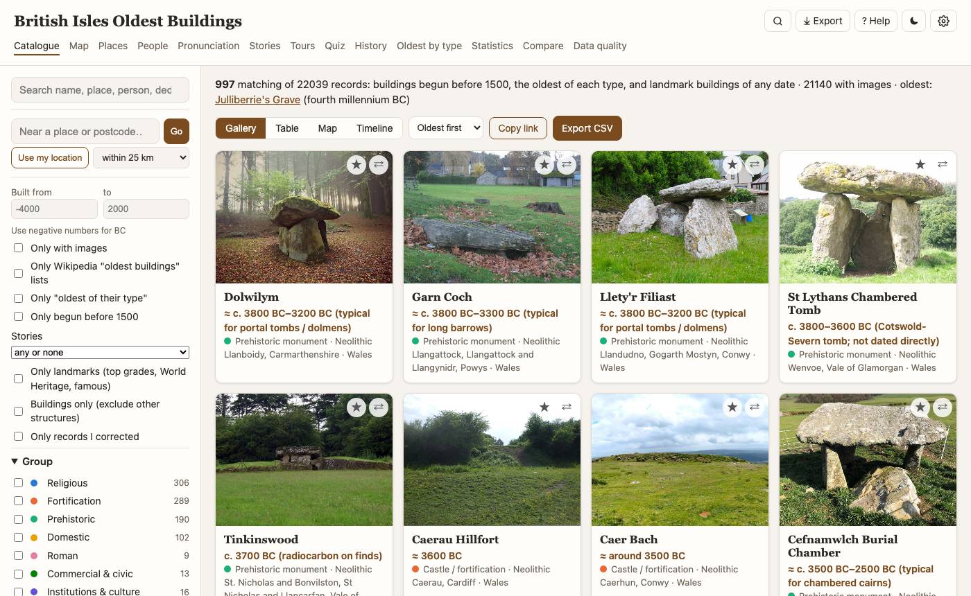
- Type in the search box (/): a name, a town, a saint, a person ("Shakespeare").
- Narrow down with the filters: building group, period, nation, county, heritage grade, date basis.
- Click a card to open the building; use ☆ to add it to the trip planner, ⇄ to compare.
- Press ⌘K (Ctrl+K on Windows/Linux) anywhere to jump to a page, building, place or person.
Accuracy and safety
⚠️ Everything here was generated automatically and may be wrong. The catalogue, places, dates, building types, materials, stories, oldest-of lists, quizzes and tours were assembled by scripts and by AI (Claude, working as a coding and research assistant), not by historians, archaeologists or surveyors, and no entry has been checked by hand. Most records come from Wikidata, Wikipedia, the heritage registers and OpenStreetMap and keep their errors; dates read from text or estimated from the kind of monument are marked "≈"; building types and materials are linked by rules that misfire. Treat it as a starting point for your own reading.
Citations. Researched claims (the oldest-of lists, Oldest things, building types and materials, trades and the change-over-time notes) were compiled with AI assistance. Each names its sources with an exact quote, and a script fetches every source again to confirm the quoted words are there (marked "quote found"). That shows the source exists and says those words, not that it is right, that the quote bears out the claim, or that no contrary source exists: those judgements were made by AI and are not verified. Verdicts: kept (the sources found agree), corrected (the popular claim is wrong; the entry gives the one the sources support), open (disputed or uncertain). Check the sources before relying on a claim, and report errors on GitHub.
Tours are computer-made suggestions, never walked, cycled or driven by anyone: see Tours for how to use them safely.
Catalogue
Views: Gallery (photos), Table (sortable columns), Map (colour by building group or period, "only what's on the map" filter) and Timeline (how many buildings were begun per century, 50, 500 or 1000 years). Near a place: type a town or postcode, or use your location, then choose a distance; sort by "Nearest first". Copy link keeps every filter, so a shared link opens the same view. Dates marked ≈ are estimates (see Date basis).
A building's page
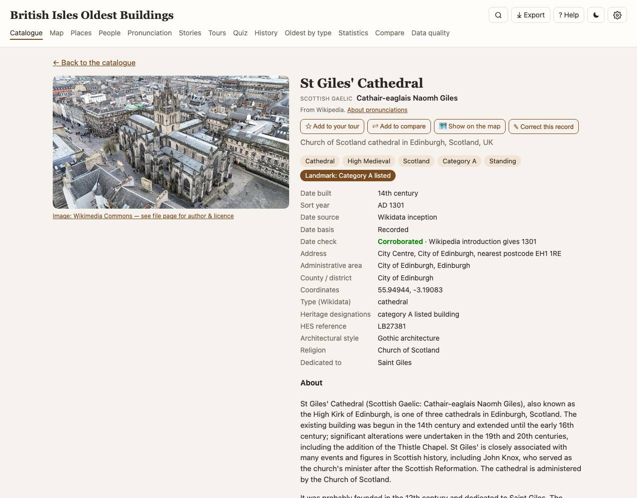
Each record shows when it was built and how we know (recorded, from the register's description, from a Wikipedia article, or estimated from the type), a date check against independent sources, its designations, address, architect and style, and a "Sources & references" box listing every source and the references Wikidata attaches to each fact. Below the map: the building's outline from OpenStreetMap, a floor plan where one exists (which can be laid over the map), historic maps of this place (scanned, georeferenced maps on Allmaps, most detailed first), people connected with it, nearby old buildings and places of interest. 🗺 Show on the map opens the Map page zoomed in on the record, ringed and named (for a place of interest its layer is switched on). Locally you can correct a record; corrections survive rebuilds.
Map
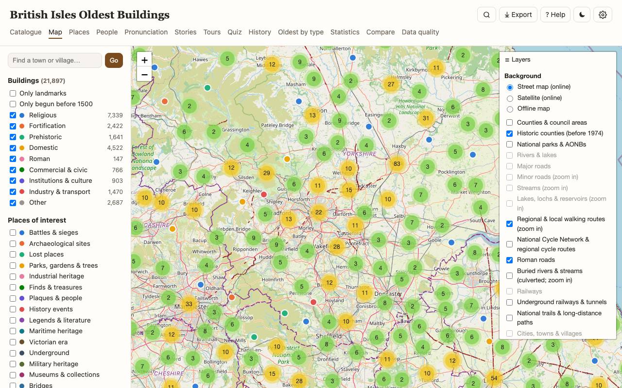
Buildings by group plus layers of places (battles, archaeology, lost places, gardens and trees, industrial sites, finds, plaques, history events). The ☰ Layers button on every map chooses the background (online street map, satellite imagery from Esri with place names (local app), or the bundled offline map), the offline layers (counties, national parks and AONBs, rivers and canals, lakes, major roads, minor roads and streams (off by default; shown when zoomed in), railways and stations, historic counties (before 1974), national trails, regional and local walking routes, the National Cycle Network and regional cycle routes, Roman roads, buried (culverted) rivers, towns, hills and coast, airports; borders, national parks, routes, trails, Roman roads, buried rivers and stations also show over the street map) and a historic map with an opacity slider: Ordnance Survey six-inch and one-inch, Roy's military survey, the Gough Map, William Smith's 1815 geological map, historical atlases, town plans and the Ordnance Survey six-inch maps of Ireland (first edition, 1829–42, and a later revision). Zoomed in, building outlines appear.
📈 Change over time (button at the top right of the Map page, and a page of its own in the menu): graphs of population, towns, income, life expectancy, woodland, farming, coal, emissions, temperature, rainfall, greenhouse gases, volcanoes, the sun and sea level, from the end of the Ice Age to today. Choose which graphs to show, and a map layer. Layers "through time" are redrawn for the slider's year (or a date chosen from the list under the layer, which also reaches back before the slider's start): the ice sheet and coast every 1,000 years from 31,000 years ago, tree cover from pollen, people per km², cropland, pasture and built-up area (modelled by HYDE), towns and cities by size since AD 700, railway stations and dated railway and canal lines, Ireland's counties at each census since 1841, decade temperature and rainfall since 1901, people from satellites (1975–2020), built-up land, night-time lights (1992–2024), tree cover lost since 2000 and land cover (2000–2018). Layers of "the land" stay fixed: bedrock geology, superficial deposits, coalfields, ancient woodland and farmland quality. The dotted line marks the slider's year and the value at it. Every graph names its source and licence, and notes say how the figures were made; where scholars or models disagree their estimates are drawn together in different colours with a legend, separate published estimates as dots with error bars, and stretches with no figures as dotted lines read as estimates (≈); dashed lines are modelled, shaded bands the source's uncertainty. The page adds tables of values, dated events (famines, plagues, great storms and frosts, floods) with citations, and the full list of sources. What the graphs show together gives short notes on how the series line up (the first farmers, the Black Death, the Little Ice Age, Laki, the Irish famines, coal and CO₂, the 1952 smog), each quoting the research it rests on; the panel beside the map lists the notes for the slider's year.
Through time (the panel at the foot of the Map page): tick it and move the slider to see what had been built, founded or opened by a year, and what had not yet closed. ▶ Play runs through the centuries; × hides the panel (🕰 Through time brings it back); Map of the time switches the historic map to the era's (Roman Britain, the Anglo-Saxon kingdoms, the Gough Map, Roy and Smith, the Ordnance Survey's Old Series and six-inch). The bars show when the things on the map were begun. Undated records are hidden while it is on, and it shows only what survives or was recorded: the early centuries look emptier than they were.
Places
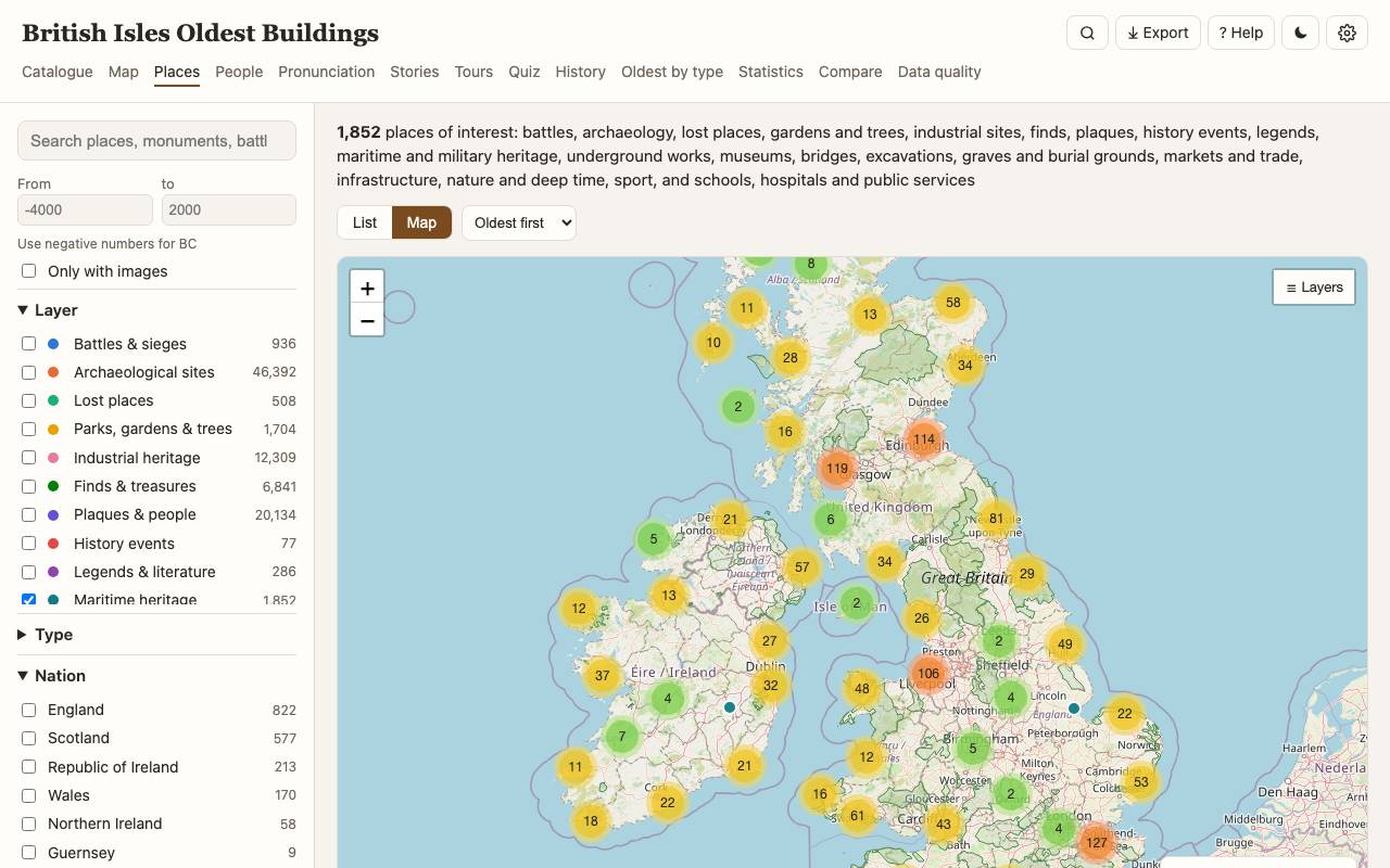
Places that are not buildings: battlefields, archaeological sites from the official registers, holy wells, hill figures, Roman roads, deserted villages, shipwrecks, registered gardens, notable trees, industrial sites, finds and hoards, objects kept in buildings, commemorative plaques (Wikidata and Open Plaques) and located history events. Filter by layer, type, nation, period and source.
People
People linked to buildings and places: buried, born, lived, worked or died there; architects, founders, owners, those commemorated by plaques and those who took part in battles. Where Wikidata gives a source for a connection, it is shown next to it.
Pronunciation
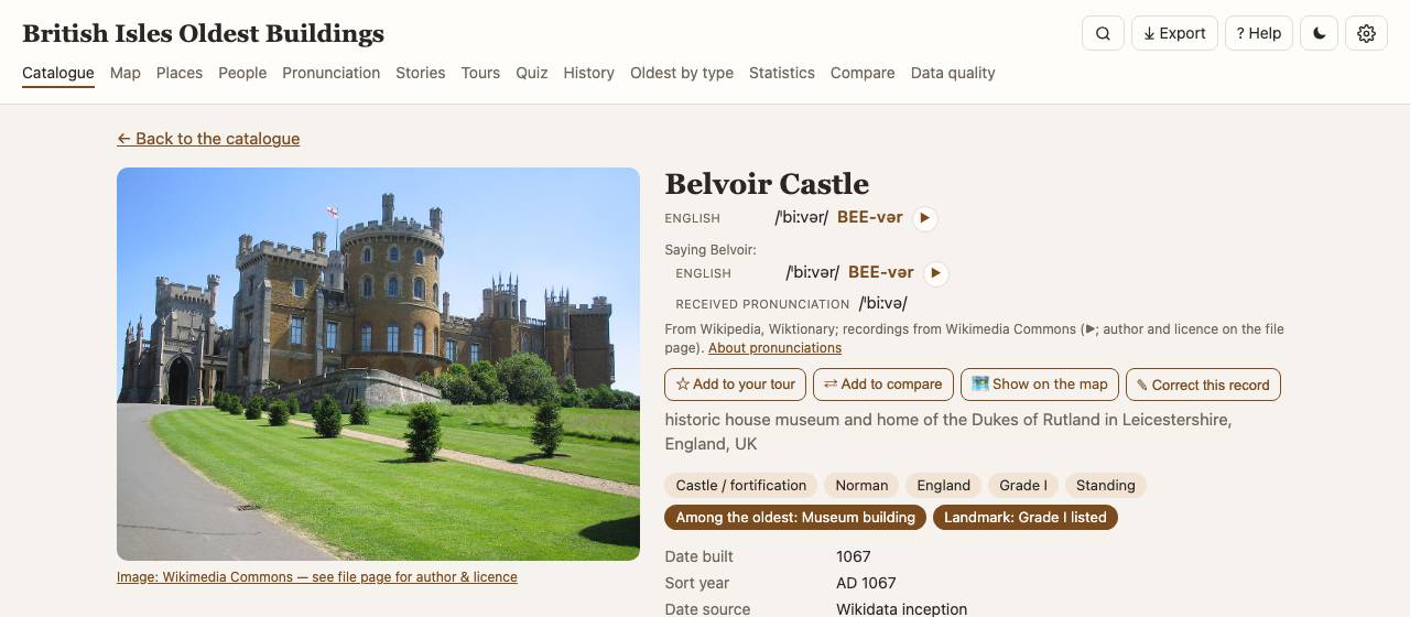
Under the name of a building, place or person you may see how it is said, and its name in other languages of the isles. Each line gives the variety (English, local, Scottish English, Welsh, Scottish Gaelic, Irish with its Munster / Connacht / Ulster dialects, Manx, Scots, Cornish, Jèrriais…), the IPA transcription between slashes, a respelling in capitals for the stressed syllable ("BEE-vər"), and ▶ to play a recording. "Saying <town>" lines are for the town or area the record lies in. The Pronunciation page lists them all, by variety, and exports them as CSV or JSON. Sources: the opening of the English Wikipedia article (CC BY-SA) and Wikidata (CC0), whose recordings are on Wikimedia Commons, many from the Lingua Libre project; each recording's author and licence are on its file page. Turn pronunciations or other-language names off in Settings.
History
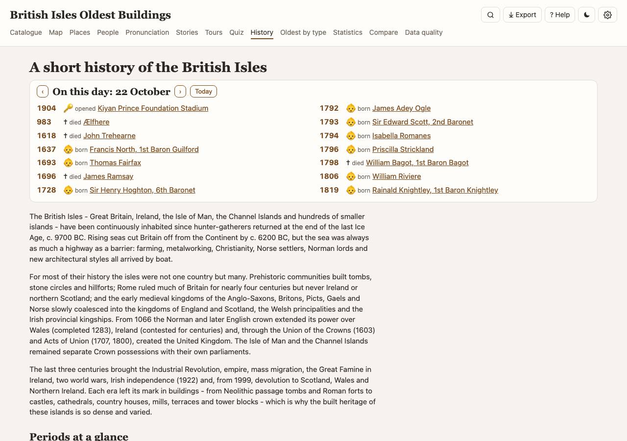
Periods from the Neolithic to the modern era, a timeline of sourced events (each checked against its source; see Data quality) and where they happened.
Trades and industries
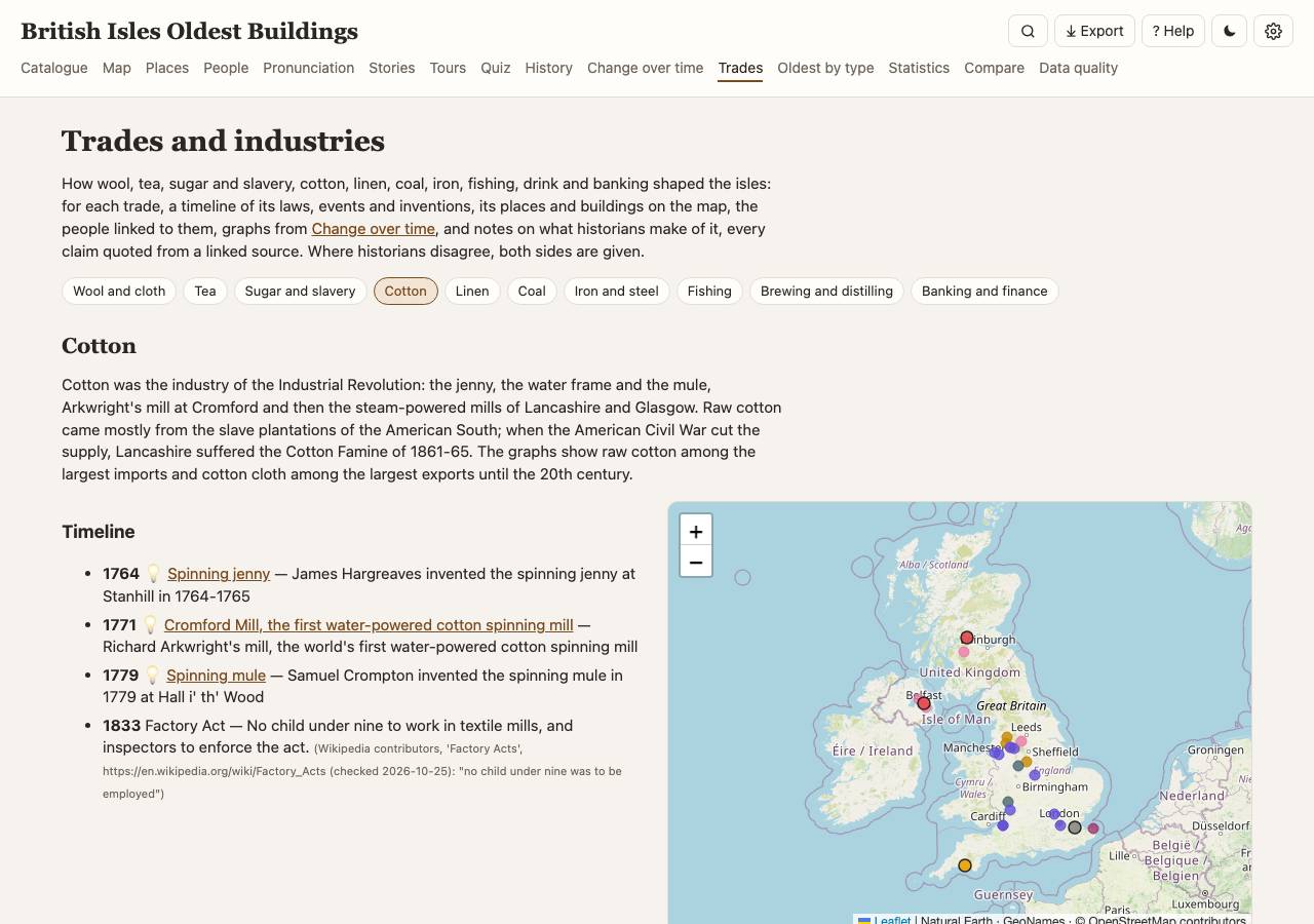
One page per trade (wool and cloth, tea, sugar and slavery, cotton, linen, coal, iron and steel, fishing, brewing and distilling, banking and finance). Each brings together its dated laws and events (with quoted sources), the inventions made for it (💡), its places and catalogue buildings on a map, the people linked to them, graphs from Change over time, and notes on what historians make of it, both sides where they disagree. Show on the Map page rings the trade's places among the other layers (or choose a Trade in the Map page's panel); Export saves its places and buildings (CSV, JSON, GeoJSON, KML) or its timeline.
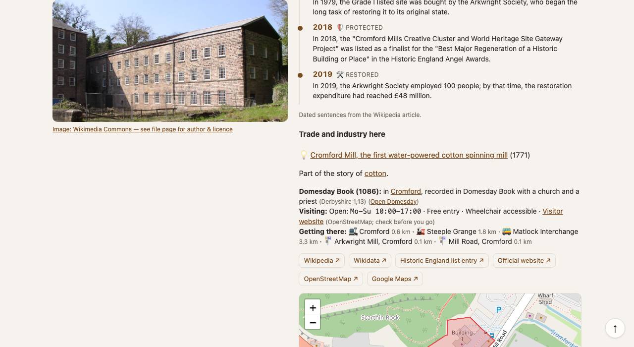
The stories are reachable from Change over time too: its law events and its graphs link to their trade. A building's or place's page shows Trade and industry here: the trade stories it belongs to and any innovation made or first used there. The 36 innovations and firsts are also a places group of their own (Innovations & firsts) and a list on the Oldest page, and the quiz has Which came first?
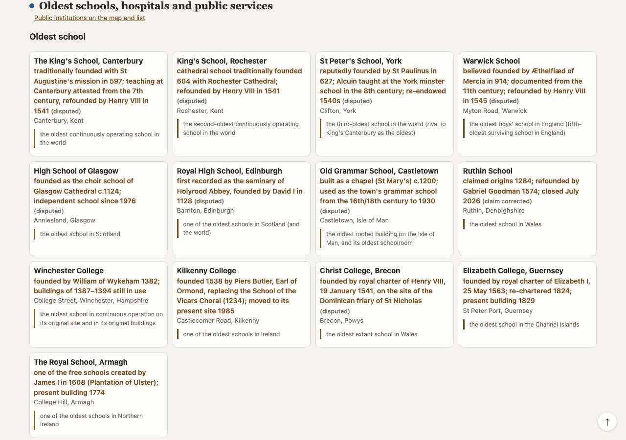
Oldest by type
For about fifty building types (castle, church, pub, bridge, lighthouse, theatre…) the oldest surviving examples, with the claim that is usually made and the evidence behind it.
Below them, researched lists of the oldest things that are not buildings: ancient trees, rocks and fossils, the earliest human traces; burials, gravestones, churchyards and cemeteries; markets, fairs, shops, firms and works; roads, waterworks, railways, canals, docks and communications. Each entry has its sources and a verdict on the claim (confirmed, corrected or open). The earliest dated places of each new kind follow, marked as unchecked Wikidata dates.
Oldest things
The oldest things that are not buildings or places, in eight themes: food and drink (recipes, cookery books, brewing records, food brands), writing (inscriptions, manuscripts, poems, letters, printing), music (songs, instruments, carols and anthems, recordings, dances), laws, documents and maps, games and sport (game pieces, the first written rules, trophies, events still held), customs and traditions, everyday things (clothes, tools and boats, coins, jewellery, clocks), and pictures, science and media.
Choose a theme, search, pick a nation, or list everything oldest first. Each entry gives its date, what it is the oldest of and how well that stands: settled (the sources agree), corrected (the popular claim is wrong, and the entry gives the one that holds) or open (disputed or uncertain). Open "sources" for the exact words of each source and whether the quote was found there at the last check. The map shows where each thing is kept, was made or found, or where a custom still takes place; click a place name to find it there.
Festivals and seasons
Festivals explores the buildings and places of the isles through the year's feasts: Christmas, New Year and Hogmanay, Burns Night, St Brigid's Day, St Valentine's and St Dwynwen's, the four national saints' days, Easter and Shrovetide, May Day, Midsummer, Lammas, Michaelmas, Halloween and Bonfire Night. The wheel shows where each falls in the year (Easter and the solstices are worked out for each year) and the cards are in order of the next one to come.
Each festival's page has researched facts and customs (filter them by history, custom, legend, food, oldest, sky or curiosity; open "sources" for the exact words quoted and whether they were found at the last check), places to visit, and what the catalogue holds for it: churches of its saints, stories that mention it, monuments said to face its sunrise, places such as holy wells or haunted castles, what happened on the day and the oldest customs from Oldest things. The map shows all of them as layers you can switch off.
Building types
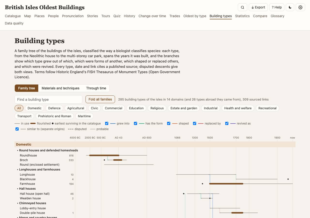
The Building types page is a family tree of about 300 kinds of building, from the roundhouse and the long barrow to the Wealden house, the tower house, the cotton mill and the railway station. The Family tree tab draws each type on a time axis, grouped by domain (houses, defence, religious, farming, industry, transport…) and family: the bar spans its years of use, thicker while it flourished, and a dot marks the earliest surviving example in the catalogue. Branches join a type to the ones it grew from, replaced or revived; each link has its sources, and dashed lines are disputed. Fold the families, pick domains with the chips, or search by name.
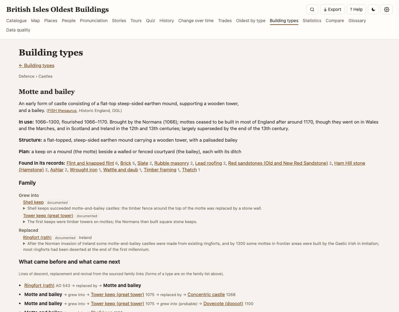
Open a type for its page: the definition from Historic England's thesaurus of monument types, its period, structure and plan, materials, family links with quoted sources (and the views where scholars disagree), what came before and what came next, its earliest surviving example, how it spread across the counties, a map and the dated examples. Dates far earlier than a type's first known date are flagged as too early (usually an older site with a later building). The Materials and techniques tab does the same for stone, timber framing, brick, roofs, glass, iron and concrete, with the sentence that names the material in each record; a stone's map shades the rock it comes from (where the geological map has that rock, within the stone's geological periods) and counts how many of its buildings stand on it. A building's page says what type it is (“This is a Wealden house: see its family”) and which materials it is known for.
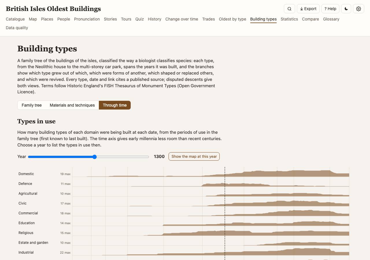
Through time shows how many types of each domain were in use at each date (choose a year to list them, or Show the map at this year) and, as a heatmap, the century each material appears in the catalogue's buildings.
Sky calendar and 3D models
The Sky calendar lists the coming solstices, equinoxes and the days between them with the monuments said to face each sunrise or sunset. Stonehenge in 3D draws the monument as it is now (every surviving stone from a numbered survey plan) or as it is thought to have been when complete, on the real ground (the Environment Agency's 1 m LiDAR) under the sun, moon and stars of any date, back to the Neolithic. Drag to turn the view, scroll to zoom (except in the standing views, where dragging looks round and up at the sky), pick a view from the list, and use the buttons to jump to midsummer sunrise, midwinter sunset or a full moon rising. Shadows follow the sun or moon. Click a stone for its record and sources; "Mark lost stones" shows which stones of the complete monument are lost.
3D models (in the menu) lists every model: Stonehenge, Bryn Celli Ddu, Newgrange, Calanais, Maeshowe with the Stones of Stenness and the Ring of Brodgar, Woodhenge with the Durrington Walls Southern Circle, and Mousa Broch. Each works like Stonehenge's, and each lists the measurements it is built from with their quoted sources, and what had to be assumed. In the passage tombs the sunbeam is real: sunlight only reaches the chamber through the openings, so at Newgrange's midwinter sunrise, Bryn Celli Ddu's midsummer sunrise or Maeshowe's sunsets around midwinter it lights the passage floor as it does on the day; "Lantern" lights up the inside at other times. A record or place with a model has a "3D model" button on its page. In this app (not the hosted copy) a quicker view of a few hundred more stone circles is built from their stones mapped on OpenStreetMap.
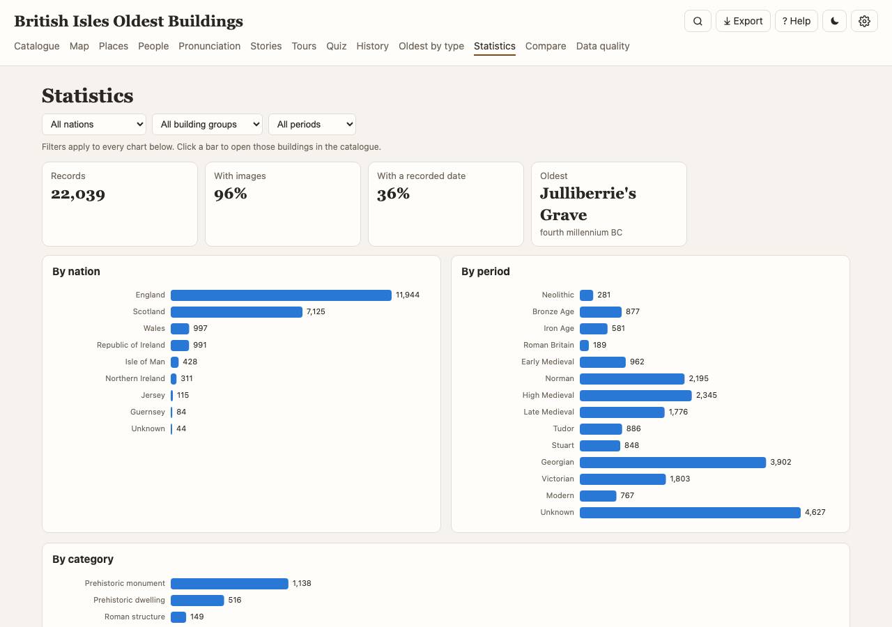
Statistics
Stories & legends
Ghosts and the supernatural, legends and myths, folklore and customs, and curious history (secret passages, priest holes, treasure, smugglers) told about the buildings and places, taken from their Wikipedia articles with a link back. They appear under Stories & legends on a building's or place's page, on the Stories page (by theme and nation, with a map), and as a Stories filter in the catalogue sidebar. Legends are told as legends: they record what people believed or said.
Tours
Ready-made tours: walks around historic towns, bike rides and day trips by car, for all sights or one of twenty themes (ghosts & legends, prehistoric, castles, early churches, Roman, maritime, industrial, Victorian, military, museums, bridges, archaeology, markets & trade, sport, schools, hospitals & town halls, graves & churchyards…), and long-distance and pilgrim ways. Routes follow real paths and roads (OpenStreetMap, OSRM); the time includes a stop at each place. Each tour opens in Google Maps for turn-by-turn directions, downloads as GPX (sat-navs, cycling and walking apps) or KML (Google Earth), prints, or copies to Your tour.
⚠️ Use the tours with care. Stops are chosen by a score and joined by an automatic route planner (OSRM on OpenStreetMap data); nobody has tested them. Routes may follow busy roads without pavements, unlit, private, closed or rough paths, river and tidal crossings or steep ground, and distances, times, climbs and surfaces are estimates. Stops may be private homes or land, closed, ruined or unsafe (cliffs, caves, mines, tunnels), or open only at times or for a fee; opening details from OpenStreetMap may be out of date. Being on a tour gives no right of access: Scotland has a general right of responsible access, England and Wales public rights of way and open-access land, and Ireland, Northern Ireland, the Isle of Man and the Channel Islands more limited rights. Plan with an official map (Ordnance Survey, OSNI or Tailte Éireann) and proper navigation, check the weather, tides, ferries and opening hours, follow the Countryside Code (the Scottish Outdoor Access Code in Scotland), respect graves, churches and private homes, and go at your own risk.
Your tour: star (☆) buildings and places anywhere, or ✨ Suggest a tour from a town, postcode, your location or the map centre, for one to two hours, half a day or a day, on a theme. Choose walking, cycling or driving and whether to return to the start; Best order finds the shortest order; + Stops along the way shows notable places close to the route to slot in. Save as many tours as you like (kept in this browser; Settings → Backup saves them to a file). Share link puts the stops in a link you can send.
Long-distance and pilgrim ways: national trails, Scotland's Great Trails, Irish waymarked ways and pilgrim routes (St Cuthbert's Way, the Fife Pilgrim Way…) as multi-day walks, with the sights near the path and day stages of about 20 km. Walks and rides show an elevation profile with the climb (from a 25 m terrain model, so short climbs are smoothed out).
On the way: 📍 Follow shows where you are, the next stop, its distance and direction, and ticks stops off as you reach them. 🔊 Listen to the tour reads out each stop and its story. Building pages show the nearest railway or bus stations, bus stops and ferry terminals in Great Britain (NaPTAN) ("Getting there") and, where OpenStreetMap knows them, who looks after the place, opening hours and whether entry is free; check before you go. Ready-made bike rides say how much is paved, unpaved and traffic-free (from OpenStreetMap, checked every 200 m along the route). In Wales, records list the old forms of the name with the dates of the sources they come from (List of Historic Place Names of Wales).
On this day, timelines and the quiz
The History page opens with On this day: battles, buildings founded or opened, and births and deaths of the people in the catalogue on today's date (‹ › for other days). Dates before 1752 are given in the calendar used at the time. A building's page has a Timeline of dated events from its article: built, rebuilt, besieged, burned, dissolved, restored.
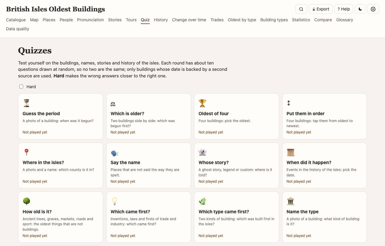
The Quiz page has fifteen quizzes of about ten questions each, drawn at random every round: Guess the period from a photo; Which is older? and Oldest of four; Put them in order (tap four buildings from oldest to newest); Where in the isles? (the county); Say the name (Belvoir, Woodnesborough, Herstmonceux: pick the right respelling); Whose story? (a ghost story or legend with the place's name hidden); When did it happen? (events of the History page); How old is it? (ancient trees, graves, markets, roads, sporting clubs, schools and the oldest things from the researched lists); Which came first? (inventions and laws of trade and industry, and the oldest things); Which type came first? (two kinds of building from the family tree); Name the type (a photo: what kind of building is it?); Oldest things (the oldest recipe, book, song, law, game, custom or photograph: which is it?); What is it built of? (a photo: which material or way of building does it use, as its official list description or Wikidata says); and a Mixed bag. Hard makes the wrong answers closer to the right one. Each answer links to the record, the round ends with a review, and your best score for each quiz and level is kept in this browser.
On the Places page and the map, Legends & literature adds reportedly haunted places, places of legend (Arthurian sites, fairy forts, Avalon, Lyonesse, Cantre'r Gwaelod: shown where tradition puts them, as claims), holy wells, and the real places where notable novels, plays and poems are set. The Literary places and Ghosts & legends tours use them, with the homes and graves of writers.
Maritime heritage adds harbours and ports, docks, shipyards, ropewalks, custom houses, lighthouses, lifeboat stations, museum ships and shipbuilders. Industrial heritage now covers the Industrial Revolution (mills, mines, ironworks, canals, railways, engine houses, kilns, iron bridges, 1700–1914) and Victorian era its public buildings, piers and glasshouses (1837–1901). Each has tours.
Underground gathers what lies below ground: tube, subway and metro stations with their opening years, closed "ghost" stations (Aldwych, Down Street, British Museum), railway, canal, road and foot tunnels (Thames Tunnel, Box, Standedge, Severn), air-raid and deep-level shelters, Cold War bunkers and Royal Observer Corps posts, caves and mines, ice houses, grottoes, catacombs and Bazalgette's sewers. The map layer Underground railways & tunnels (☰ Layers) draws the tube lines and tunnels; there are Underground tours.
Military heritage covers defences through the ages after the castles: the Saxon burhs of the Burghal Hidage, Henry VIII's Device Forts, Martello towers, the Palmerston Forts, batteries, barracks and drill halls, and the works of the world wars and the Cold War: pillboxes and anti-tank defences, stop lines, radar stations and sound mirrors, airfields and prisoner-of-war camps, and war memorials. The map layer Pillboxes, bunkers & trenches shows several thousand smaller works mapped on OpenStreetMap. Tours: Coastal defences and Military heritage.
Museums & collections lists museums of every kind (national, local, regimental, transport, science, historic houses), art galleries, and libraries and archives, closed ones marked as closed. A museum's page has Kept here: its best-known objects (the Rosetta Stone and the Lewis chessmen at the British Museum, the Arnolfini Portrait at the National Gallery), and finds and hoards link to the museum that holds them. There are Museums & galleries town walks.
Bridges gathers the bridges on Wikidata by type: clapper and packhorse bridges and stepping stones, aqueducts, swing and bascule bridges, suspension and cable-stayed bridges, railway viaducts, footbridges and road bridges, with the year each opened. The bridges begun before 1500 and the famous ones are in the catalogue as well. There are Bridges tours.
Excavations shows where archaeologists have dug: sites with recorded excavations and every Time Team dig, with what the team looked for. A building or place that has been excavated says when and by whom (Excavated: under "Getting there"), and Finds & treasures now includes the hoards in Wikipedia's lists, with where each was found, when, what it held and the museum that keeps it. Find-spots of metal-detected finds are kept vague on purpose by the Portable Antiquities Scheme, so only published hoards are shown. Tours: Archaeology & digs.
Offline use and installing
The offline map (☰ Layers → Offline map) works without internet: counties and historic counties, roads (minor roads and streams when zoomed in), lakes, rivers, trails, stations and towns. In the local app, ⬇ Save this area for offline in the Layers panel keeps the street map of the area in view (zoom 10–15) in the data folder, for a walk or a tour; Settings → Maps lists and deletes saved areas. The local app can be installed from the browser (Install / Add to Home Screen); pages, tours and the places you opened then also work offline.
Compare
Up to three buildings side by side (mark them with ⇄).
Data quality
Where the data is incomplete or sources disagree: undated records, date conflicts (with the conflicting sentence quoted), missing photos or coordinates, and the research claims checked against their sources. Links go straight to the Wikidata item, so gaps can be fixed at the source.
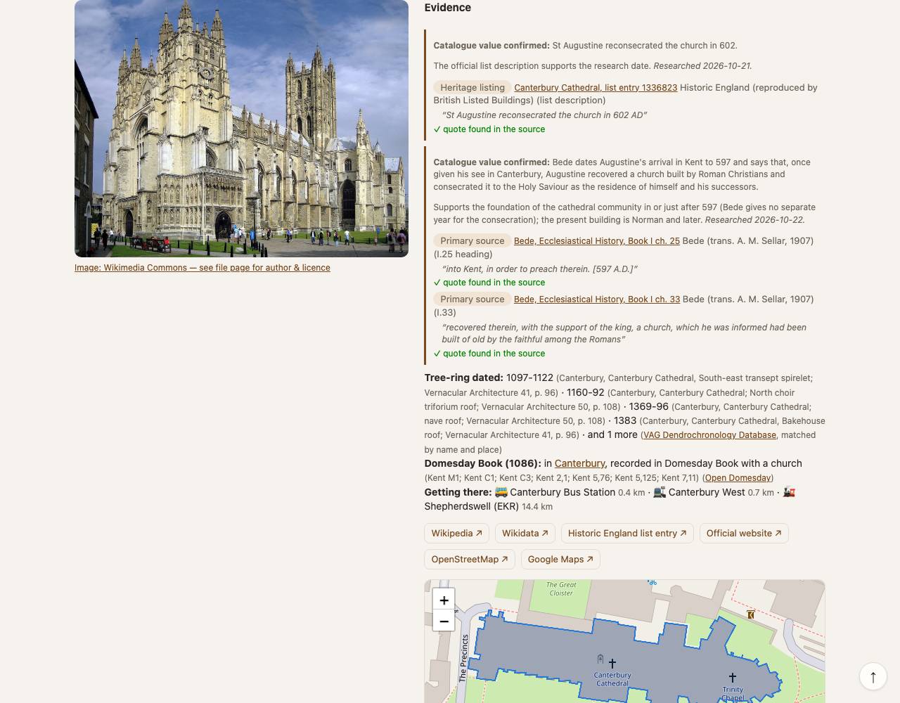
On a record's page, Evidence lists each researched claim with its sources (primary source, heritage listing, secondary or reference work), the exact quote and whether the last check found it in the source; tree-ring dates and the Domesday Book entry follow.
Rebuild and other jobs (local app): rebuild the database, find photos, outlines and floor plans, offline map layers, the hosted copy, and packaging the database for a new installation. Each shows its stage, a progress bar, downloads vs cache hits and the time left (estimated from the last run). Jobs keep running if you close the page or the app; reopen the Data quality page to follow them, or Stop one. Downloads are cached, so a rebuild reuses them; to pick up newer Wikidata or Wikipedia edits, open the rebuild options and download again what is older than some days, or everything from chosen sources.
Settings
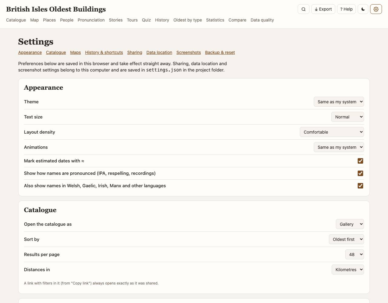
Appearance: theme (system, light, dark; or press T), text size, compact layout, reduced motion. Catalogue: how it opens (view, sort, results per page) and distance units. Maps: default background and marker clustering. History & shortcuts: recently viewed records, single-key shortcuts. Data location (local app): where the download cache and the database are kept, with the free space on each drive. Move or copy them to an external drive, back to the project folder, or any folder; the app checks every file before switching and deleting the old copy, and tells you if a drive is unplugged. Backup: save your trip list, compare list, map layers and preferences to a file and load them elsewhere.
Export & screenshots
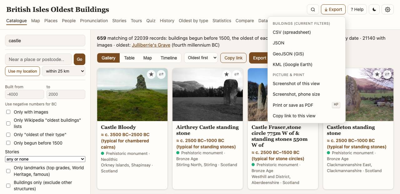
The ⤓ Export menu (X) saves what you are looking at:
- Data for the current filters: buildings, places or people as CSV (spreadsheets), JSON, GeoJSON (QGIS and other GIS) or KML (Google Earth).
- Screenshot of the current view, at your window size or phone size (local app; uses Chrome in the background).
From a terminal:
.venv/bin/python -m app.screenshot /map map.png --width 1280 --height 800 --theme dark. - Print or save as PDF: pages print without menus and filters.
- Copy link to this exact view.
Direct links for scripts: /export/buildings.csv?nation=Wales&period=Medieval,
/export/places.geojson?kind_group=Battles+%26+sieges, /export/people.json?role=Architect,
/api/screenshot?path=/stats&w=1280&h=800.
Keyboard shortcuts
| / | Search on this page |
| ⌘K / Ctrl+K | Go to a page, building, place or person |
| ? | Show shortcuts |
| T | Light / dark theme |
| X | Export menu |
| G then C M P E H O S T R D , | Catalogue, Map, Places, pEople, History, Oldest, Statistics, Trip, compaRe, Data quality, Settings |
| Esc | Close menus and dialogs |
Glossary
The main terms are below; the Glossary page has all of them: designations, periods, dating, architecture and archaeology, the registers, and the building types.
- Date built
- When construction began (the earliest surviving fabric where sources say so).
- Date basis
- Recorded: Wikidata or a curated Wikipedia list. From register description: the official listing text (Historic Environment Scotland, Cadw). From Wikipedia article: mined from the article, with the sentence kept as evidence. Estimate (building type): the accepted date range for that kind of monument. Not recorded: no date found. Anything but "Recorded" shows ≈.
- Date check
- Corroborated: another source agrees within 100 years (500 for prehistoric dates). Referenced: the date carries a reference on Wikidata. Single source: nothing independent to compare. Conflict: another source is more than 150 years away; worth a look.
- Landmark
- Included regardless of date: Grade I (England, Wales), Category A (Scotland), Grade A (Northern Ireland), World Heritage Sites, structures with articles in many languages, Crown Dependency heritage.
- Oldest of its type
- Among the earliest surviving examples of a building type, from Wikidata and researched claims.
Questions
Why is a building missing?
The catalogue starts from Wikidata and the official registers. A building without a Wikidata item, or without a date before 1500 and not a landmark, will not appear. Adding the date on Wikidata brings it in at the next rebuild.
A date looks wrong. What can I do?
Open the record, check the date basis and evidence, and use "Correct this record" (local app) or fix it on Wikidata (link on the record).
Why are some photos "taken nearby"?
Records without a photo get the nearest geotagged Wikimedia Commons photo; the caption says when it may show the surroundings rather than the building itself.
The map is blank or grey.
The online street map needs internet. Choose "Offline map" under ☰ Layers, or make it the default in Settings.
The app says the data folder is not available.
The download cache or database is on a drive that is not connected. Plug it in, or choose another location in Settings → Data location (Use a copy that is already there).
Starting on a new computer.
Without a database the app opens on its
setup page: use the bundled database (downloaded from the project's GitHub release), point it at data you already have (a drive with the cache and/or
database), or build from scratch (hours, in the background). From the terminal: ./run.sh --data
/Volumes/MyDrive, --bundled or --build.
Does anything I do here leave my computer?
Searches and preferences stay in your browser. Looking up a place name or postcode asks postcodes.io / OpenStreetMap; maps and photos load from their servers.
Sources & licences
- Wikidata (CC0); Wikipedia and Wiktionary text (CC BY-SA 4.0: each passage links to its article, whose history names the authors); photos from Wikimedia Commons (each file's own licence, named under the photo with a link to the file page).
- Historic England, Historic Environment Scotland, Cadw, Department for Communities (Northern Ireland): Open Government Licence. National Monuments Service and NIAH (Ireland): CC BY 4.0.
- Open Plaques: public domain. postcodes.io: OGL. Map data © OpenStreetMap contributors (ODbL); Natural Earth (public domain); GeoNames (CC BY 4.0).
- Historic maps: National Library of Scotland (CC BY), David Rumsey Map Collection via Allmaps (CC BY-NC-SA 3.0: non-commercial use), Wikimaps Warper, Bodleian Libraries; see each layer's attribution. The Roy Military Survey (© British Library) is shown live from the NLS only and is not copied into the hosted version.
- Domesday Book entries: Open Domesday (Anna Powell-Smith), data J.J.N. Palmer, University of Hull, CC BY-NC-SA: non-commercial use only.
- Tours: routes © OpenStreetMap contributors (ODbL) by OSRM at routing.openstreetmap.de (FOSSGIS); heights produced using Copernicus data and information funded by the European Union (EU-DEM layers), via OpenTopoData.
- Tree-ring dates: Vernacular Architecture Group, Dendrochronology Database (Archaeology Data Service, doi:10.5284/1132568). Its terms allow non-commercial research use, so the matched entries are shown in the local app only; records keep the one felling date that dates them.
- The graphs and map layers of Change over time cite their sources on that page; every source and licence is
listed in
DATA_LICENSE.mdin the repository.
About
An open project: code at
github.com/gddickinson/british-isles-oldest-buildings.
This copy of the data was built 2026-10-20 13:46 (22,046 catalogue records).
The code is under the MIT License; the data keeps its sources' licences (Wikipedia text CC BY-SA, OpenStreetMap
data ODbL, heritage registers OGL / CC BY, Wikidata CC0): see DATA_LICENSE.md in the repository.
Screenshots in this guide show photos from Wikimedia Commons (each under its own licence, credited on its file page), map tiles © OpenStreetMap contributors, Esri World Imagery (© Esri, Maxar, Earthstar Geographics) and National Library of Scotland maps (CC BY).